The Nagar District is administratively subdivided into two tehsils namely: “Nagar-1 and Nagar-2”.The valley is situated at an elevation of 2,438m (7,999 feet).
It was created in 2015 by subdividing the Hunza-Nagar District.
Today, the famous Karakoram Highway crosses Nagar, connecting Pakistan to China via the Khunjerab Pass. The road follows the Hunza-Nagar River for some distance through Nagar and into the Hunza region.
Location
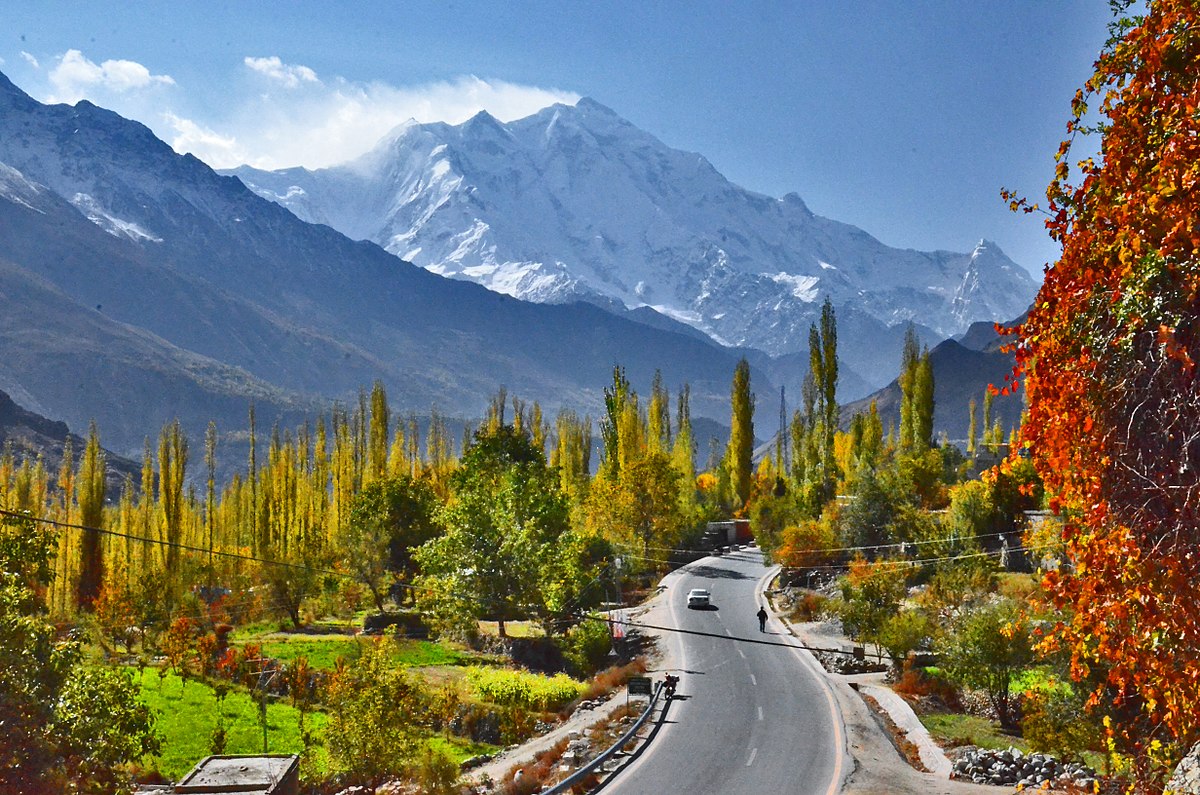
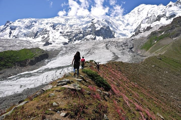
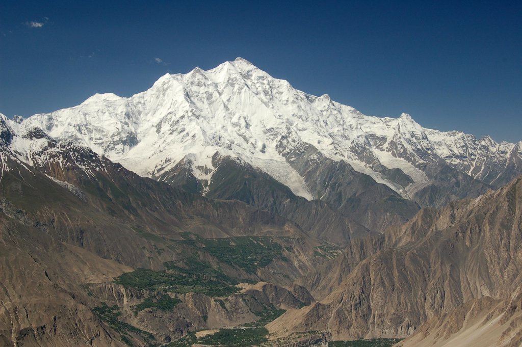
The Nagar valley previously known as Broshal, is situated at an elevation of 2,438m (7,999 feet). Nagar Khas is the main town and the capital of the former State of Nagar. Ghulmet, Minapin, BAR, Chaprote and Hopper Valleys are popular tourist attractions in the Nagar region because of the spectacular scenery of the surrounding and the most intimidating high mountain peaks on earth such as Rakaposhi at 7,788m (25,561 feet), and Diran, and Spantik peak also known as (Golden peak) and several others to be discovered.
History
Following the Hunza-Nagar Campaign of 1889–1892 (known locally as the Anglo-Burusho war) the area passed under British control and then as a vassal of the Kashmir Durbar, but was ruled by the same royal family. In 1974, Zulfiqar Ali Bhutto dissolved the Princely States of Nagar and Hunza and gave democratic representation to the Northern Areas Council, now known as the Northern Areas Legislative Council. The British wanted to expand their trade to Russia from here, but the states wouldn’t allow them to.
Royal titles and styles
The name for the ruler in Nagar was Thum in Brushaski and Ra in Shina language, which is also a respectful appellation used by people of both Hunza and Nagar who belong to the clan of Boorish. The titles for prince and princess and the styles of Highness and Royal Highness for members of the Royal Family are still used here. In Hunza and Nagar Royal family men are called Gushpoor and Royal family women are titled as Soni.
Tourist Attraction places:
Rakaposhi:
Rakaposhi, Nagar GB (Pakistan)
Elevation 7,788 m (25,551 ft)
Ranked : 27th
Location : Nagar Valley, Gilgit-Baltistan, Pakistan
Parent range : Rakaposhi-Haramosh Mountains, Karakoram
Climbing
First ascent : 1958 by Mike Banks and Tom Patey
Easiest route : Southwest Spur – glacier/snow/ice
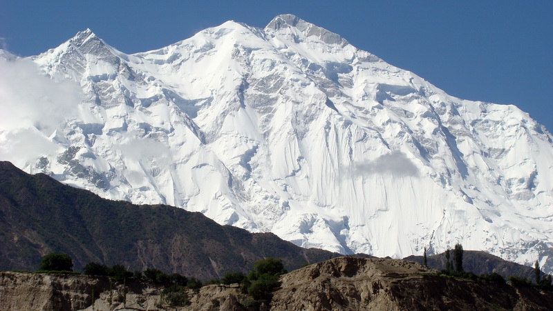
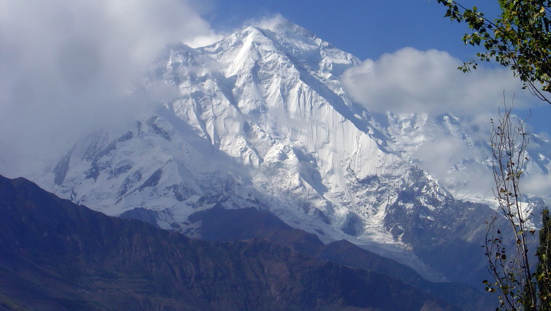
Rakaposhi is a mountain in the Karakoram mountain range in Northern Pakistan. It is situated in the middle of Nagar Valley Nagar District and Danyore and Bagrote valley approximately 100 km (62 mi) north of the capital city Gilgit of the semi-autonomous Gilgit-Baltistan region of Northern Pakistan. Rakaposhi means “Snow Covered” in the local language. Rakaposhi is also known as Dumani (“Mother of Mist” or “Mother of Clouds”). It is ranked 27th highest in the world and 12th highest in Pakistan.
The first successful recorded ascent by non-natives was in 1958 by Mike Banks and Tom Patey, members of a British-Pakistani expedition, via the Southwest Spur/Ridge route.[3][4] Both of them suffered minor frostbite during the ascent to the summit on June 25. Another climber slipped and fell on the descent and died during the night.
Rush Lake:
Location : Nagar Valley Gilgit-Baltistan
Type : Alpine lake, Glacial Lake
Primary outflows : Miar Glacier
Surface elevation : 4,694 m (15,400 ft)
Settlements : Nagar Valley, Gilgit Baltistan
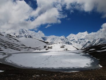
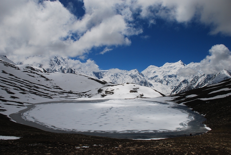
Rush Lake is a high altitude lake located in Nagar Valley, Gilgit-Baltistan, Pakistan near Rush Pari Peak, 5,098 m (16,726 ft). At 4,694 meters, Rush is one of the highest alpine lakes in the world. It is located about 15 km (9 mi) north of Miar Peak and Spantik (Golden Peak), which are in the Nagar Valley. It is the highest lake in Pakistan and 25th highest lake in the world.
Rush Lake and Rush Peak is reached via Nagar and Hopar and via the Hopar Glacier (Bualtar Glacier) and Miar Glacier, which rises from Miar and Phuparash peaks. The trek to Rush Lake provides views of Spantik, Malubiting, Miar Peak, Phuparash Peak and Ultar Sar.
Dayal
The very mention of Gilgit-Baltistan conjures up images of majestic mountains, amazing glaciers and diverse wildlife. But this remote scenic region is also home to small community of high-mountain people who practice Shamanism, locally called Dayalism. Little is known about this ancient spiritual practice to the outside world.
The practitioners, called Dayals, inhale the smoke of burning juniper branches, dance to a special music, enter into ecstatic trances, drink blood from a freshly severed goat’s head and converse with ‘spirits’ to find solution to the problems of the people who come to seek their help, according to anthropologists.
“A Dayal plays three major roles,” says anthropologist Altaf Hussain, who is a native of Gilgit. “He/she is a spiritual healer, a soothsayer and a bridge between humans and the world of spirits,” says Hussain who studied from the Quaid-i-Azam University in Islamabad.
Interestingly, the center of Dayalism in Gilgit-Baltistan is Chaprote, a village in Nagar Valley close to the point where continental plates are believed to have collided 55 million years ago. Dayalism is still popular among the natives of Gilgit who seek the practitioners’ services for casting out black magic.
“He [Dayal] was awe-inspiring,” says Tufail Ahmed, a resident of Gilgit who recently called a Dayal to his home to neutralize the effects of a magic spell ‘cast by his enemies’.
“Once in trance, he rushed to the main gate and asked us to dig the ground,” recalls Ahmed. “We kept on digging until he stopped us to recover a piece of paper wrapped in plastic with names of our family members written on it.”
Ahmed believes the Dayal successfully cast out the black magic. The Dayal is offered money as gratitude for his/her services.
Becoming a Dayal
Mujahid Shah, a resident of Nagar, says the process of becoming a Dayal begins with several stages of meditation. “Special music is played and juniper leaves are burnt as incense, which the Dayal inhales to get attuned with the spirits,” he says. Music helps induce a trance, prompting the practitioner to dance. Spiritually, he soars and sings during his mystical journey, and his song is construed as an answer to the problem for which his help has been sought.
Continental drift: Where two worlds collide
“Collision Point of Continental Plates,” reads the signpost, apart from offering information about the place where the Indian and Eurasian continental plates are said to have collided almost 55 million years ago.
Nagar
The Nagar District is administratively subdivided into two tehsils namely: “Nagar-1 and Nagar-2”.The valley is situated at an elevation of 2,438m (7,999 feet).
It was created in 2015 by subdividing the Hunza-Nagar District.
Today, the famous Karakoram Highway crosses Nagar, connecting Pakistan to China via the Khunjerab Pass. The road follows the Hunza-Nagar River for some distance through Nagar and into the Hunza region.
Location
The Nagar valley previously known as Broshal, is situated at an elevation of 2,438m (7,999 feet). Nagar Khas is the main town and the capital of the former State of Nagar. Ghulmet, Minapin, BAR, Chaprote and Hopper Valleys are popular tourist attractions in the Nagar region because of the spectacular scenery of the surrounding and the most intimidating high mountain peaks on earth such as Rakaposhi at 7,788m (25,561 feet), and Diran, and Spantik peak also known as (Golden peak) and several others to be discovered.
History
Following the Hunza-Nagar Campaign of 1889–1892 (known locally as the Anglo-Burusho war) the area passed under British control and then as a vassal of the Kashmir Durbar, but was ruled by the same royal family. In 1974, Zulfiqar Ali Bhutto dissolved the Princely States of Nagar and Hunza and gave democratic representation to the Northern Areas Council, now known as the Northern Areas Legislative Council. The British wanted to expand their trade to Russia from here, but the states wouldn’t allow them to.
Royal titles and styles
The name for the ruler in Nagar was Thum in Brushaski and Ra in Shina language, which is also a respectful appellation used by people of both Hunza and Nagar who belong to the clan of Boorish. The titles for prince and princess and the styles of Highness and Royal Highness for members of the Royal Family are still used here. In Hunza and Nagar Royal family men are called Gushpoor and Royal family women are titled as Soni.
Tourist Attraction places:
Rakaposhi:
Rakaposhi, Nagar GB (Pakistan)
Elevation 7,788 m (25,551 ft)
Ranked : 27th
Location : Nagar Valley, Gilgit-Baltistan, Pakistan
Parent range : Rakaposhi-Haramosh Mountains, Karakoram
Climbing
First ascent : 1958 by Mike Banks and Tom Patey
Easiest route : Southwest Spur – glacier/snow/ice
Rakaposhi is a mountain in the Karakoram mountain range in Northern Pakistan. It is situated in the middle of Nagar Valley Nagar District and Danyore and Bagrote valley approximately 100 km (62 mi) north of the capital city Gilgit of the semi-autonomous Gilgit-Baltistan region of Northern Pakistan. Rakaposhi means “Snow Covered” in the local language. Rakaposhi is also known as Dumani (“Mother of Mist” or “Mother of Clouds”). It is ranked 27th highest in the world and 12th highest in Pakistan.
The first successful recorded ascent by non-natives was in 1958 by Mike Banks and Tom Patey, members of a British-Pakistani expedition, via the Southwest Spur/Ridge route.[3][4] Both of them suffered minor frostbite during the ascent to the summit on June 25. Another climber slipped and fell on the descent and died during the night.
Rush Lake:
Location : Nagar Valley Gilgit-Baltistan
Type : Alpine lake, Glacial Lake
Primary outflows : Miar Glacier
Surface elevation : 4,694 m (15,400 ft)
Settlements : Nagar Valley, Gilgit Baltistan
Rush Lake is a high altitude lake located in Nagar Valley, Gilgit-Baltistan, Pakistan near Rush Pari Peak, 5,098 m (16,726 ft). At 4,694 meters, Rush is one of the highest alpine lakes in the world. It is located about 15 km (9 mi) north of Miar Peak and Spantik (Golden Peak), which are in the Nagar Valley. It is the highest lake in Pakistan and 25th highest lake in the world.
Rush Lake and Rush Peak is reached via Nagar and Hopar and via the Hopar Glacier (Bualtar Glacier) and Miar Glacier, which rises from Miar and Phuparash peaks. The trek to Rush Lake provides views of Spantik, Malubiting, Miar Peak, Phuparash Peak and Ultar Sar.
Dayal
The very mention of Gilgit-Baltistan conjures up images of majestic mountains, amazing glaciers and diverse wildlife. But this remote scenic region is also home to small community of high-mountain people who practice Shamanism, locally called Dayalism. Little is known about this ancient spiritual practice to the outside world.
The practitioners, called Dayals, inhale the smoke of burning juniper branches, dance to a special music, enter into ecstatic trances, drink blood from a freshly severed goat’s head and converse with ‘spirits’ to find solution to the problems of the people who come to seek their help, according to anthropologists.
“A Dayal plays three major roles,” says anthropologist Altaf Hussain, who is a native of Gilgit. “He/she is a spiritual healer, a soothsayer and a bridge between humans and the world of spirits,” says Hussain who studied from the Quaid-i-Azam University in Islamabad.
Interestingly, the center of Dayalism in Gilgit-Baltistan is Chaprote, a village in Nagar Valley close to the point where continental plates are believed to have collided 55 million years ago. Dayalism is still popular among the natives of Gilgit who seek the practitioners’ services for casting out black magic.
“He [Dayal] was awe-inspiring,” says Tufail Ahmed, a resident of Gilgit who recently called a Dayal to his home to neutralize the effects of a magic spell ‘cast by his enemies’.
“Once in trance, he rushed to the main gate and asked us to dig the ground,” recalls Ahmed. “We kept on digging until he stopped us to recover a piece of paper wrapped in plastic with names of our family members written on it.”
Ahmed believes the Dayal successfully cast out the black magic. The Dayal is offered money as gratitude for his/her services.
Becoming a Dayal
Mujahid Shah, a resident of Nagar, says the process of becoming a Dayal begins with several stages of meditation. “Special music is played and juniper leaves are burnt as incense, which the Dayal inhales to get attuned with the spirits,” he says. Music helps induce a trance, prompting the practitioner to dance. Spiritually, he soars and sings during his mystical journey, and his song is construed as an answer to the problem for which his help has been sought.
Continental drift: Where two worlds collide
“Collision Point of Continental Plates,” reads the signpost, apart from offering information about the place where the Indian and Eurasian continental plates are said to have collided almost 55 million years ago.
